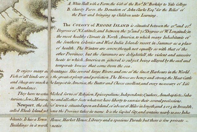
The map’s text includes a description of the colony of Rhode Island at the time as viewed by a British functionary (a transcription and more discussion of the map are available at the Gaspee Virtual Archives):

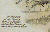
The map also includes details of military importance:

Not exactly Here Be Dragons, but similar in its way. The map also lists gun batteries (with the number of guns and size of cannon balls—18 or 24 pounds—they fired), principal farms and farm owners in the colony and soundings throughout the Bay. (Someone with the time might compare the soundings in 1764 with more recent numbers.)
A copy of the map in the David Rumsey Collection is, like this one, divided into 16 sections and mounted. The Rumsey copy includes images of the slipcase in which the sections were originally housed.
* Based on a letter presumably written by Robert Melville and reprinted as “A British Navy Yard Contemplated in Newport, R.I., in 1764.” in The Rhode Island Historical Magazine, vol. 6 (1885-6), pages 42-7. In the letter Blaskowitz is referred to as “Mr. Charles Blaskerwich” and described as “an able surveyor,” although young.

As interesting as the Faden publication of Blaskowitz’s map of Narragansett Bay is to the history of Newport, Rhode Island and the greater Narragansett Bay area it is more than worth looking at the image of Blaskowitz’s original sketch or ‘rough’ from which the Faden publication – and the later Des Barres (and Faden) ‘Plan of the Town of Newport’ is taken. The rough was produced by Blaskowitz in his own hand, complete with the list of principle farmers and land-owners of Rhode Island in the late 1760s. The image – never before seen in the USA (or elswhere come to that), held by Heritage Charts, may be viewed (and purchased in a variety of sizes) at our website. This unique image, along with other rare and significant images by Blaskowitz, Holland, Wheeler, Grant, Des Barre and others may be viewed this September at the Newport International Boat Show at the Heritage Charts stand (tent ‘C’, booth 66). For further information on this rare chart please feel free to contact me at aadamson@heritagecharts.com. We would love to be able to present and discuss our rare and significant collection to members of the Rhode Island Historical Society and where possible, contribute to the knowledge base.
Andrew Adamson
Heritage Charts
Copy and paste the following URL into your browser:
http://www.heritagecharts.com/mapchart.php/20/2/a_plan_of_rhode_island_with_the_country_and_islands_adjacent_including_a_plan_of_the_town_of_newport